The Importance of Earth Observing Satellites for Africa
Earth observing satellites are essential tools for Africa’s development, offering valuable data to support applications in agriculture, disaster management, transportation, energy, and climate and environmental monitoring. By enabling informed decision-making, these technologies help enhance food security, public safety, infrastructure planning, and climate resilience across the continent.
Pam Sullivan (*)
6/16/20254 min read
Satellite technology grows more powerful year by year, creating the opportunity to use Earth observation data to improve decision making in a wide range of applications. Today dozens of satellites, in particular, COPERNICUS programme and EUMETSAT meteorological satellites, which are of easy access to African countries, provide observations of Africa’s landmass, atmosphere, and surrounding oceans. These include satellites with specialized sensors designed to monitor land use, weather, and air and water quality. Increasing the use of data from these satellites can enhance the safety and prosperity of African people and businesses and help governments respond to natural disasters and climatic change.
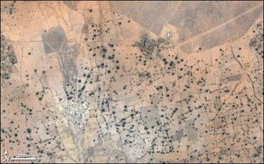
Land Use and Agriculture
Satellites such as ESA’s Sentinel-2 and NASA’s LandSat are designed to provide high spatial resolution (10-60 meter) data of the Earth’s land surface with a revisit period of every 7-10 days. Imagery from these satellites can be used to monitor land use, analyze crop health, assess needs for fertilizer and irrigation, detect pests, predict crop yield, and project the impacts of droughts and floods. Satellites can facilitate precision farming, where resources are allocated efficiently based on real-time data, leading to sustainable agricultural practices and increased food security. Satellite data can also be used to monitor water levels in lakes, rivers, and reservoirs to forecast water availability and develop water management plans. Trending satellite data over time can show changes in land use, illustrating the effects of deforestation, urbanization, and climate change.
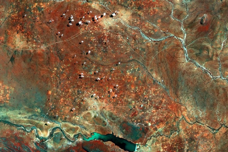
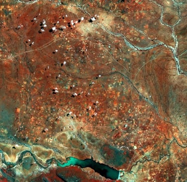
Credit: ESA / Copernicus Sentinel-2A http://www.esa.int/spaceinimages/Images/2017/03/Central_District_Botswana
Weather Forecasting and Disaster Management
Satellites such as EUMETSAT’s MeteoSat are designed to monitor weather in real time (with images refreshed every 10 minutes or faster), providing immediate warning for storms and other dangerous conditions including cyclones, thunderstorms, high winds, flooding, dust/sand storms, and wildfires. Knowledge of these conditions allows people to take measures to protect themselves and their communities. This data can be used by governments to prepare for and respond to natural disasters, directing assistance to the most-impacted areas and assessing what infrastructure is available to support recovery efforts.

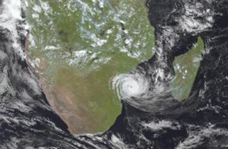
Credit: EUMETSAT MeteoSat-9 shows Cyclone Freddie.
Transportation, Construction, Energy, and Retail Industries
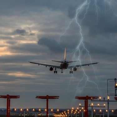
MeteoSat and other satellites operated by EUMETSAT and the U.S. provide input data to numerical weather models which predict future weather conditions. These forecasts are essential for safe and efficient operations in many industries. Transportation operators can use this data to direct airplane, ship, and truck travel around dangerous weather conditions and to optimize travel routes based on the expected conditions. The construction industry can use the data to plan crane operations on low wind days and to determine how quickly concrete will set in given temperature and humidity conditions. The energy industry can use this data to predict energy needs based on forecasted temperatures. Retail industries can plan for consumer demand based on the forecast need for rain gear, warmer clothes, etc. Also, any industry with outdoor operations (agriculture, construction, forestry, fishing, recreation, etc) can use forecast data to keep their workers safe by avoiding dangerous weather conditions or providing protective shelter and clothing.

Climate and Environment
With their global perspective and 50+ years of observing, satellites provide a unique record of how our planet is changing. Certain satellites[1] are designed with a specific mission to measure the concentration of greenhouse gases in the atmosphere which drive climate change. Other satellites monitor the effects of climate change over time by tracking global temperatures, weather patterns, the number and intensity of tropical cyclones, floods, droughts, sea level rise, changes in ocean currents, geographical shifts of ecosystems, vegetation health, melting of glaciers and polar ice, bleaching of coral reefs, wildfires, and ocean acidification. Governments and other organizations [2] can use this data to mitigate climate-impacting activities, and to develop plans to respond to the effects of climate change on their communities.

Credit: NASA Earth Observatory, showing desertification in Mali.
Summary and Additional Resources
In conclusion, Earth observing satellites are pivotal for Africa's development across multiple sectors. Their ability to provide accurate, real-time data transforms public safety, enhances industries from agriculture to transportation, and enables climate and environmental monitoring. By harnessing satellite technology, Africa can enhance its socio-economic progress, achieve sustainable development, and improve the quality of life for its people.
To learn more about Earth-observing satellites and their applications, you can visit:
- https://www.esa.int/Applications/Observing_the_Earth
- https://science.nasa.gov/earth/
Here are just a few of the places where recent satellite imagery can be viewed:
- https://dunia.esa.int/datasets
- https://view.eumetsat.int/productviewer?v=default
- https://eumetview.eumetsat.int/static-images/
- https://landsat.gsfc.nasa.gov/data/data-access/
- https://search.earthdata.nasa.gov/search
- https://www.star.nesdis.noaa.gov/portfolio/index.php
Here are organizations that have helped apply satellite imagery to meet African needs:
- https://www.digitalearthafrica.org/
- https://deafrica.africageoportal.com/
- https://africanspaceagency.org/portfolio_page/earth-observation/
(*) About the author :
Pam Sullivan retired in 2025 from the U.S. National Oceanic and Atmospheric Administration (NOAA), where she served as the Director of Geostationary Earth Orbit Observations, leading the development of NOAA’s geostationary weather satellites. Before NOAA, Sullivan spent her career at NASA, contributing to more than a dozen space missions that expanded the understanding of the Earth, Sun, and universe, and protected humankind from dangerous weather and environmental conditions.
About
IRES aims at producing innovative and transformative political solutions for Cameroon and Africa.
Contact
+32486106100
© IRES 2024. All rights reserved.
Privacy policy